
South China Sea
A strategic maritime region where trade routes, resource claims, and territorial disputes intersect
The South China Sea is a major maritime region in Southeast Asia where overlapping claims, vital trade routes, fisheries, energy resources, and military activity make it a central Indo-Pacific flashpoint.
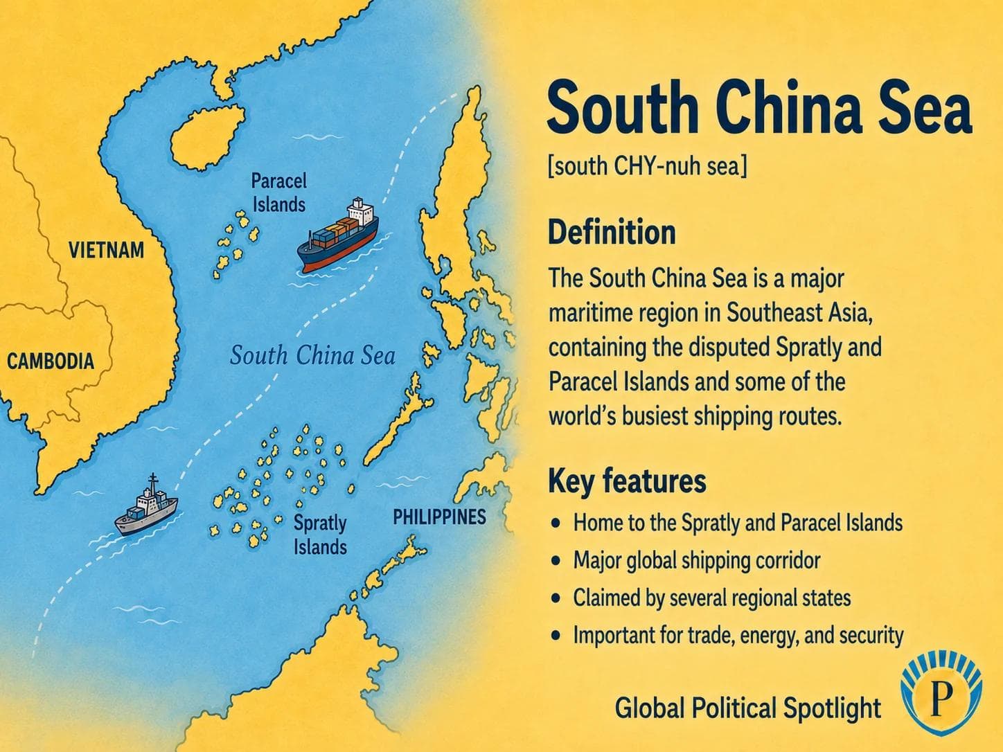
Definition
The South China Sea is a semi-enclosed sea in the western Pacific bordered by China, Taiwan, the Philippines, Malaysia, Brunei, Indonesia, Vietnam, and nearby Southeast Asian waters. It connects the Pacific and Indian Ocean trade systems through routes linking the Strait of Malacca, the Singapore Strait, the Taiwan Strait, and the wider Indo-Pacific.
The region is contested because several governments assert overlapping claims over islands, reefs, maritime zones, fisheries, and seabed resources. The Spratly Islands, Paracel Islands, Scarborough Shoal, and China’s nine-dash-line claim are among the most prominent reference points in the dispute.
Why It Matters
The South China Sea matters because it is one of the world’s most important maritime corridors. Commercial shipping, energy flows, undersea infrastructure, fishing fleets, and naval operations all depend on a stable maritime environment in and around the sea.
It is also a major test case for maritime law, freedom of navigation, coercive statecraft, and regional deterrence. Incidents involving coast guards, maritime militia, fishing vessels, and naval forces can quickly become diplomatic or military crises involving China, Southeast Asian claimants, and outside powers such as the United States.
GPS should track the South China Sea as a persistent Indo-Pacific flashpoint where maritime law, Chinese regional power projection, Southeast Asian sovereignty claims, fisheries, energy exploration, trade routes, and U.S.-China strategic competition converge. Key watchpoints include incidents around Second Thomas Shoal, Scarborough Shoal, the Spratly Islands and Paracel Islands, new basing or infrastructure activity, ASEAN-China code of conduct negotiations, freedom of navigation operations, and legal or diplomatic statements invoking UNCLOS.
Key Facts
- Type
- Strategic maritime region and disputed sea
- Location
- Western Pacific, between mainland Southeast Asia, southern China, Taiwan, the Philippines, Borneo, and the Malay Peninsula
- Primary claimants
- China, Taiwan, Vietnam, the Philippines, Malaysia, and Brunei, with Indonesia affected by claims near the Natuna area
- Key disputed features
- Spratly Islands, Paracel Islands, Scarborough Shoal, Pratas Islands, and multiple reefs, banks, and low-tide elevations
- Legal framework
- Maritime entitlements are generally assessed under the UN Convention on the Law of the Sea, though sovereignty claims over land features remain contested
- Trade relevance
- A major global shipping corridor connecting East Asia, Southeast Asia, the Indian Ocean, and the wider Pacific economy
- Resource relevance
- Important for fisheries, potential offshore hydrocarbons, seabed rights, and coastal livelihoods
- Security relevance
- A focal point for naval presence, coast guard confrontations, artificial island infrastructure, freedom of navigation operations, and regional deterrence
FAQ
What is the South China Sea?
The South China Sea is a strategic sea in the western Pacific bordered by China, Taiwan, Vietnam, the Philippines, Malaysia, Brunei, Indonesia, and nearby Southeast Asian waters. It is important for shipping, fisheries, energy resources, and military access.
Why is the South China Sea disputed?
The dispute involves overlapping claims to islands, reefs, maritime zones, fisheries, and seabed resources. China, Taiwan, Vietnam, the Philippines, Malaysia, and Brunei all assert claims in parts of the sea, while Indonesia is affected by overlapping maritime pressures near the Natuna Islands.
What is the nine-dash line?
The nine-dash line is the map-based claim used by China to indicate extensive rights or interests across much of the South China Sea. A 2016 arbitral tribunal found that China’s historic rights claim within the line had no legal basis under UNCLOS, but Beijing rejected the ruling.
Why does the South China Sea matter for global trade?
The South China Sea is a major maritime corridor linking East Asian manufacturing centers with Southeast Asia, the Indian Ocean, Europe, and the Middle East. Disruption would affect shipping routes, energy flows, supply chains, and insurance and logistics costs.
What are the Spratly and Paracel Islands?
The Spratly and Paracel Islands are groups of islands, reefs, and maritime features in the South China Sea. They are central to sovereignty disputes because control over land features can affect nearby maritime claims, military access, and resource rights.
Is the South China Sea only a China-Philippines issue?
No. China and the Philippines are often prominent in recent incidents, but the wider dispute also involves Vietnam, Taiwan, Malaysia, Brunei, and the interests of outside powers concerned with navigation, maritime law, and regional balance of power.
Recent Developments
An arbitral tribunal issued a major South China Sea ruling
A tribunal constituted under the UN Convention on the Law of the Sea issued an award in the Philippines v. China arbitration. The ruling rejected the legal basis for China’s historic rights claim within the nine-dash line and remains a central reference point in South China Sea legal debates, although China rejected the award.
Permanent Court of ArbitrationSecond Thomas Shoal remained a recurring flashpoint
Incidents involving Chinese and Philippine vessels around Second Thomas Shoal continued to highlight the role of coast guards, resupply missions, maritime claims, and alliance signaling in the South China Sea.
Philippines Department of Foreign AffairsSources6 references
- Permanent Court of Arbitration
Official case page for the South China Sea arbitration between the Philippines and China.
- United Nations Convention on the Law of the Sea
Core treaty text governing maritime zones, exclusive economic zones, continental shelves, and maritime rights.
- U.S. Energy Information Administration
Reference overview of energy resources and shipping relevance in the South China Sea.
- ASEAN
Text of the 2002 Declaration on the Conduct of Parties in the South China Sea.
- U.S. Department of State
Official U.S. legal analysis of China’s maritime claims in the South China Sea.
- Asia Maritime Transparency Initiative
Research and mapping resource on maritime claims, island infrastructure, and South China Sea security dynamics.

GPSNews App
Read GPSNews on iPhone
Daily geopolitical briefings, government updates, and prediction signals in one focused app.
Newsletter
Stay Ahead Of The Next Signal
Get briefings in your inbox when new analysis and reports are published.