
GPS Jamming & Spoofing
Electronic attacks that disrupt or falsify satellite navigation signals
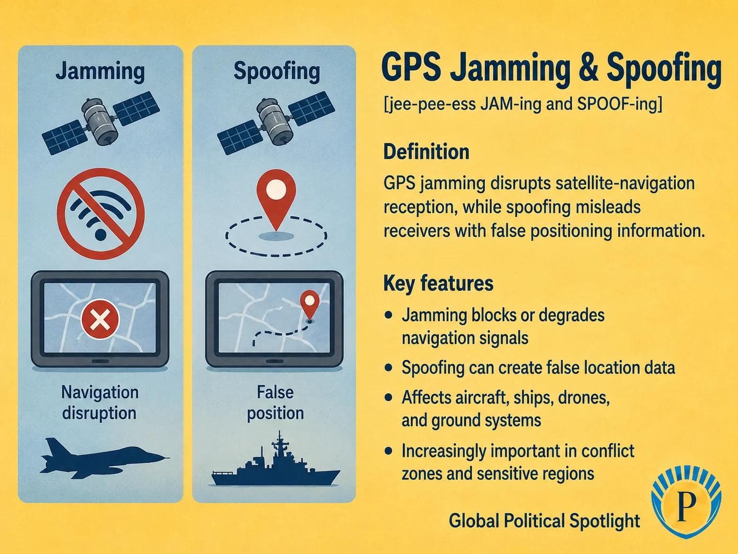
GPS jamming blocks or weakens satellite navigation reception, while GPS spoofing sends false positioning or timing data. Both can disrupt aircraft, ships, drones, vehicles, and military systems that rely on satellite navigation.
Definition
GPS jamming and spoofing are forms of electronic interference against satellite navigation signals. Jamming overwhelms or blocks weak satellite signals so receivers cannot calculate a reliable position, while spoofing transmits deceptive signals that can make a receiver calculate a false position, time, speed, or route.
Although the term GPS is often used broadly, the issue affects the wider Global Navigation Satellite System environment, including systems such as GPS, Galileo, GLONASS, and BeiDou. Civilian aviation, maritime shipping, drones, financial timing systems, telecommunications, and military platforms all depend on accurate positioning, navigation, and timing.
Why It Matters
GPS jamming and spoofing matter because modern societies and militaries rely on satellite navigation far beyond map directions. Aircraft navigation, ship routing, drone control, precision weapons, emergency services, telecom synchronization, and financial networks can all be affected when positioning or timing data becomes unreliable.
In conflict zones and contested border regions, navigation interference can act as a low-cost way to disrupt surveillance, targeting, logistics, and civilian traffic. The growing use of drones and autonomous systems makes resilience against jamming and spoofing a central issue for both national security and infrastructure planning.
GPS should monitor GPS jamming and spoofing as a persistent feature of modern electronic warfare and infrastructure vulnerability. Key watch areas include interference around conflict zones, aviation and maritime safety alerts, drone operations, military dependence on precision navigation, backup timing systems, and national policies for positioning, navigation, and timing resilience.
Key Facts
- Type
- Electronic interference against satellite navigation signals
- Jamming
- Blocks, overwhelms, or degrades satellite signal reception
- Spoofing
- Sends deceptive signals that can create false position, time, or route data
- Affected systems
- Aircraft, ships, drones, vehicles, ground forces, telecommunications, and timing-dependent infrastructure
- Strategic role
- Can disrupt surveillance, targeting, navigation, logistics, and command systems without direct physical attack
- Common risk areas
- Conflict zones, borders, maritime chokepoints, military exercises, and areas near electronic warfare activity
- Civilian risk
- Navigation interference can affect aviation safety, maritime routing, emergency response, and commercial operations
- Resilience measures
- Backup navigation, inertial systems, multi-constellation receivers, signal authentication, mapping cross-checks, and disciplined operating procedures
FAQ
What is GPS jamming?
GPS jamming is the deliberate or accidental blocking of satellite navigation signals. Because GNSS signals are weak when they reach Earth, a nearby transmitter can interfere with reception and make a receiver lose or degrade its position fix.
What is GPS spoofing?
GPS spoofing is the transmission of false navigation signals that mislead a receiver into calculating an incorrect position, time, speed, or route. Spoofing can be more deceptive than jamming because the receiver may appear to be working while showing false data.
Why do GPS jamming and spoofing matter in conflict zones?
They matter because modern militaries use satellite navigation for drones, vehicles, aircraft, ships, targeting, logistics, and timing. Interference can reduce situational awareness, complicate movement, and disrupt precision operations.
How can GPS interference affect aircraft and ships?
Aircraft and ships use satellite navigation for position awareness, route planning, timing, and navigation support. Interference can create wrong position data, trigger cockpit or bridge alerts, force crews to use backup procedures, or increase workload in busy or high-risk areas.
Is GPS the only satellite navigation system affected?
No. GPS is the U.S. system, but jamming and spoofing can affect the wider GNSS environment, including Galileo, GLONASS, BeiDou, and regional augmentation systems. Many users rely on receivers that combine multiple constellations.
How can systems become more resilient to GPS jamming and spoofing?
Resilience can include backup navigation methods, inertial navigation, multi-constellation and multi-frequency receivers, signal authentication, terrain or visual cross-checks, disciplined procedures, and training operators not to rely blindly on a single positioning source.
Recent Developments
Aviation regulators continued to warn about GNSS interference risks
European aviation safety authorities continued to publish safety information on GNSS jamming and spoofing, reflecting the growing relevance of satellite navigation interference for aircraft operations near conflict-affected and high-risk regions.
European Union Aviation Safety AgencyMaritime authorities highlighted GNSS disruption as a navigation risk
The International Maritime Organization and maritime safety bodies continued to treat GNSS interference as a navigational safety issue for shipping, especially where vessels rely heavily on satellite positioning for route planning, port approaches, and situational awareness.
International Maritime OrganizationSources6 references
- U.S. Cybersecurity and Infrastructure Security Agency - GPS
U.S. government reference on GPS dependence, critical infrastructure, and positioning, navigation, and timing resilience.
- European Union Aviation Safety Agency - GNSS Outages and Alterations
Official aviation safety information on GNSS jamming, spoofing, outages, and operational risk.
- International Civil Aviation Organization
International aviation organization relevant to navigation standards, safety procedures, and GNSS use in civil aviation.
- International Maritime Organization
International maritime organization relevant to ship navigation, maritime safety, and GNSS-related operational risks.
- U.S. Space Force - Global Positioning System
Official U.S. military reference on GPS as a positioning, navigation, and timing system.
- European Union Agency for the Space Programme - Galileo
Institutional reference for Europe's GNSS constellation and the broader satellite navigation ecosystem.
GPSNews App
Read GPSNews on iPhone
Daily geopolitical briefings, government updates, and prediction signals in one focused app.
Newsletter
Stay Ahead Of The Next Signal
Get briefings in your inbox when new analysis and reports are published.